
Southern Arizona Was Once A Vast High-Elevation Plateau And Looked Like Tibet
Don Wood – MessageToEagle.com – We normally think of southern Arizona and the surrounding areas as hot, cactus-laden deserts with relatively low base elevations, below 3,000 feet, but this is not what the region looked like in the distant past.
A recent study by the University of Wyoming that much of the southwestern United States was once a vast high-elevation plateau, similar to Tibet today.
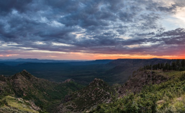
Coconino National Forest, Arizona. Image Source
Jay Chapman, an assistant professor in UW’s Department of Geology and Geophysics explains recent research suggests that, during the Late Cretaceous to Early Paleogene period (80-50 million years ago), the region may have had elevations in excess of 10,000 feet and looked more like the Tibetan plateau north of the Himalayan Mountains or the Altiplano in the Andes Mountains in South America.
See also:
Ancient France Was Once An Exotic Rainforest And Had Amazon-Like Jungles
Huge Molten Iron River Is Moving Rapidly Beneath Our Feet – It’s Heading Towards Europe
Seychelles Islands Are Sinking And Will Soon Disappear Underwater
Scientists analyzed the chemistry of igneous rocks to determine how thick Earth’s crust was in the past and then related the thickness to elevation.
“Earth’s crust floats in the mantle just like an iceberg floats in the water, with a little bit sticking out above the surface,” Chapman says. “When the crust is thicker, the height of mountains and the elevation of the land surface are higher, just like the height of an iceberg sticking out of the water is taller if the overall iceberg is larger.”
The study determined that the crust in southern Arizona was once almost 60 kilometers thick, which is twice as thick as it is today — and comparable to how thick the crust is in parts of the Himalayas.
“While the ancient mountains were forming, magma intruded into the crust and formed rocks like granite,” Chapman says. “When the crust was really thick, the magmas experienced extreme pressure from the weight of all the rocks above them, which caused distinctive changes in the types and the chemistry of the minerals that formed those rocks.”
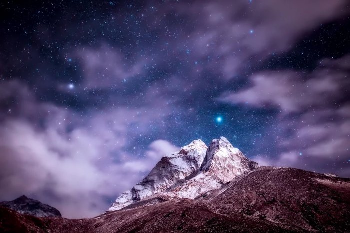
The Himalayas. Credit: Public Domain
One of the interesting questions the study raises is how the crust in southern Arizona became so thick in the past.
“The most common way to make really thick crust is for tectonic plates to converge or collide, which produces large earthquakes and faults that stack rock masses overtop one another,” he says.
“The prevailing view of southern Arizona is that there was never enough faulting in the area to make the thickness of crust we observe. It is a bit of a conundrum as to how such thick crust was generated.”
The study titled “Geochemical evidence for an orogenic plateau in the southern U.S. and northern Mexican Cordillera during the Laramide Orogeny,” which was published online Nov. 22 in the journal Geology.
Written by Don Wood – MessageToEagle.com Staff
Related Posts
-
 Researchers Find 70 Percent Increase In Atmospheric Hydrogen Over The Past 150 Years
-
 New Giant 50-Metre Deep Sinkhole Just Opened Up In The Arctic – This One Is Unique Scientists Say
-
 Surprisingly High Levels Of Mercury In Greenland’s Glacier Meltwaters Discovered
-
 The 460Km-Long River Beneath Antarctic Ice Sheet Could Affect Ice Loss
-
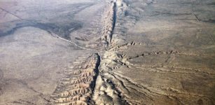 An Overlooked Strand Of The Southern San Andreas Fault May Pose A Major Earthquake Risk
-
 Underwater Tsunamis Created By Glacier Calving Cause Vigorous Ocean Mixing
-
 New Living Building Materials May Reduce Greenhouse Gas Emissions
-
 Hidden Mangrove Forest In The Yucatan Peninsula Reveals Ancient Sea Levels
-
 North Atlantic Current May Cease Temporarily And Change Weather In Europe In The Next Century
-
 New Satellite Images Show Giant Iceberg Will Split From Antarctica Anytime Now