
Controversial And Mysterious Man-Made Garut Pyramid With A Secret Past
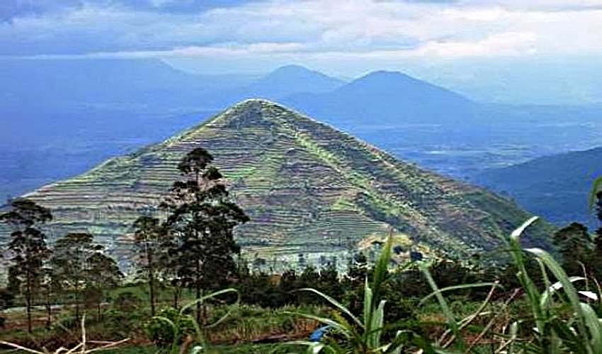
MessageToEagle.com – The so-called ‘Garut Pyramid’ located in Garut, West Java province of Indonesia, is an intriguing, man-made structure.
For now, researchers have not been able to determine the exact shape of the structure, why it is located in this particular place and who built it.
Prior to testing, a series of excavations were carried out and revealed a number of covert rock inscriptions and that the pyramid buried within the hill would be larger than that of the Great Pyramid of Giza.
The height of the structure, constructed approximately 10,000 years ago, was estimated to reach 200 meters.

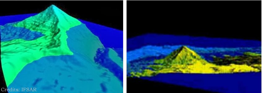
The Ancient Catastrophic Disaster Team has carried out verification to determine the existence of a man-made structure in Garut using Superstring geo-electric instruments to scan geological layers on the hill by measuring its resistivity.
The results of the geo-electric instruments within 20 meters and 10 meters electrodes showed that there was a horizontal nonconformity on the intrusion (red) rocks within around 120 meters from the summit, said Iwan Sumule, a member of the Ancient Catastrophic Disaster Team in a written statement.
The finding shows that the right-side intrusion branch seems to form a terrain morphological base that has similar topographical elevation with Cirahong valley.
Then, the 120 meter-limit seems to coincide with the base of a steeper ascending topography, where the rocks turn red.
The results confirmed the conclusion that the structure is highly unlikely to be of natural formation.
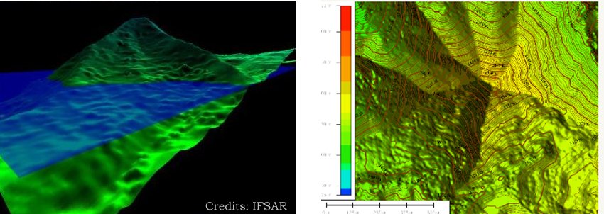
The result of a 3D contour plot topographical digital data with 5 meter resolution IFSAR has supported the hypothesis that there exists an anomaly formation made of sinder cone hill geological process located on a horizontal nonconformity intrusion base.
Moreover, the excavation material source comes from Cirahong valley which was located 1-2 kilometers from the summit of Mount Putri. It is proven that the material volume from Cirahong valley is similar to the material volume from Mount Putri.
The C14 carbon testing result showed that the age of the ancient top soil layer that has been tested by carbon dating C14 in BATAN is 6000 BC. Meanwhile, the age of the harder soil layer underneath is 7500 BC.
If there is any hard soil structure underneath the layer, then the age would be older.
It is assumed that these people vanished due to natural catastrophes such as earthquakes and v olcano eruptions.
Earlier, the Directorate General of History and Antiquities of the Ministry of Education and Culture stated that Indonesia may have pyramids.
Story source:
Viva News, Tribunnews.com.
© MessageToEagle.com
Related Posts
-
 Don’t Underestimate The Rishis – Ancient Sages Were ‘Probably Great Scientists’
-
 Mysterious Emerald Tablet – Ancient Time-Capsule Of Forbidden Knowledge
-
 The Red-Haired Race And The Atlantean Connection – Amentet And Elysium – Part 2 of 3
-
 Unexplained Phenomenon Of The Dancing Mania That Occurred During The Middle Ages
-
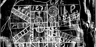 Undeciphered Ancient Stone Maps With Mysterious Signs May Hold Key To The Spider Rock Treasure
-
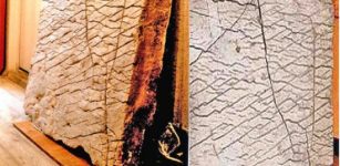
 Golden ‘Etruscan’ Orphic Book – Six Golden Pages Of The Oldest Book In History Of Mankind
-
 Controversial 120 Million-Year-Old “Map Of The Creator”
-
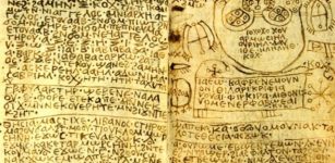 Ancient Mystery Of Baktiotha And The Egyptian Spell Book
-
 Sound Healing And Crystal Therapy, Ancient Arts Being Practiced Today – What Does Science Say?
-
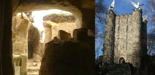 Mysterious 70-Million-Year-Old Underground Village And Magnificent Tower Of Eben-Ezer In Belgium