




Eddie Gonzales Jr. – MessageToEagle.com – Utah researchers study ice cores and 20th-century weather data to track changes in a massive ice sheet covering 760,000 square miles, with an average thickness of 3,400 feet.
Climate patterns in the tropics help determine how much snow falls from year to year on Antarctica, among the coldest, windiest, driest places on Earth.
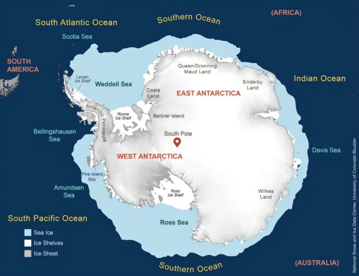
Map of Antarctica. Credit: National Snow and Ice Data Center. (University of Utah)
New research from the University of Utah shows that tropical conditions and the oceans also influence the continent’s massive ice sheets.
By analyzing ice cores recovered from the West Antarctic Ice Sheet (WAIS) and 20th-century weather data, an interdisciplinary team of scientists demonstrated that what happens in the tropics, especially in the Pacific and Indian oceans, affects how much snow falls in West Antarctica. Tropical climate patterns, such as El Niño and the Madden–Julian Oscillation (MJO), send atmospheric ripples called Rossby waves south toward Antarctica. These waves alter wind patterns and storm tracks, influencing how much moisture reaches the ice sheet, according to Ella Hunter, a graduate student in atmospheric sciences.
Her recently published study documented the variability of snow accumulations on the ice sheet over the 20th century.
“Our biggest takeaway was the influence of the tropics on snowfall in Antarctica. Rossby waves can affect temperature, winds and precipitation across the globe,” said Hunter, first author of the paper in JGR Atmospheres. “Tropical convection or heating in the tropics from sea surface temperatures can create storms that propagate these Rossby waves”—named for meteorologist Carl-Gustaf Rossby. “And they are really effective at transporting heat and moisture down to the Antarctic ice sheet,” Hunter said.
The next best thing to weather stations
These findings are based on the research team’s analysis of 25 ice cores, some of which were recovered by geography professor Summer Rupper of the U’s School of Environment, Society & Sustainability, a co-author on the paper.
“What’s unique about this study is leveraging all these cores together to look more carefully at the drivers of the variability, not just the trends. We tend to focus on the trends, but variability matters a lot for ice sheet stability,” said Rupper, an expert on Earth’s cryosphere, the parts covered in frozen water, such as glaciers, pack ice and ice sheets. Ancient ice preserves a record of past climate and atmospheric composition, and these regions serve as bellwethers for ongoing climate change.
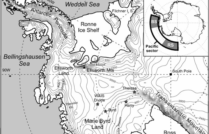
Much smaller than its eastern counterpart, the WAIS covers 760,000 square miles, with an average thickness of 3,400 feet of ice. If it all melted, its water would raise global sea levels by more than 15 feet.
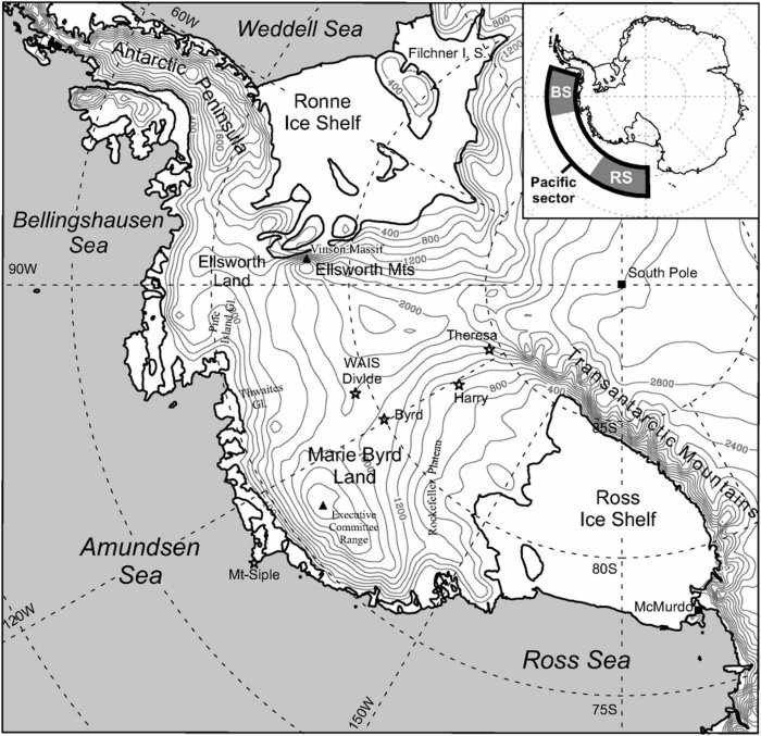
West Antarctica. Credit: Journal of Climate
The U team analyzed West Antarctic ice cores that recorded snow accumulations between 1900 and 1999, along with historical climate datasets, to understand how the ice sheet’s surface mass balance, or SMB, changed over time. SMB is the net gain or loss of ice at the surface, mainly from snowfall and wind redistribution.
Rupper extracted some of the 5-centimeter-diameter cores used in the study during field excursions to Antarctica in 2010 and 2011. They were cut into 1-meter lengths, sliced in half lengthwise, then extensively studied over the years. Rupper retains samples in special freezers on the U’s Salt Lake City campus, along with cores from Greenland’s ice sheet.
To recover the cores, Rupper’s lab used a portable drill that can bring up ice cylinders from the ice sheet’s upper 50 meters, representing snow that fell only in the last century or two.
That’s fairly shallow, but such cores are essential for reconstructing weather patterns from recent decades. Weather stations don’t hold up in Antarctica’s remote, harsh conditions.
“You can’t keep weather stations maintained. They just get buried by snow. They get blown over. We think about the deep cores, but these shallow cores are essentially filling the gaps of weather stations,” Rupper said. “Without them, we wouldn’t have any knowledge of the weather of that system. Ice cores can’t record the same things that a weather station would, but we have proxies. What I like about this study is it’s taking advantage of these.”
A tale of two West Antarcticas
A key finding from the study is that West Antarctica does not behave as a single uniform system. The researchers identified two regions—east and west—that respond differently to climate influences.
The ice cores showed that the eastern part of the WAIS received twice as much snow per year as the western part: about 350 millimeters of water equivalent per year compared with 175 millimeters. But more importantly, the study documented the year-to-year variations in accumulations and connected those variations with tropical weather. The team also documented how accumulations trended upward on the eastern part of the ice sheet, but decreased on the western part.
Over the 20th century, the surface mass balance in the east increased at a rate of 0.224 millimeters of water equivalent per year, whereas the west decreased by a rate of 0.087 millimeters per year, Hunter said.
Snowfall was higher in parts of West Antarctica associated with high pressure, which initially perplexed research team leader Court Strong, a professor of atmospheric sciences, until Hunter found an explanation.
“Ella did some really helpful detective work by looking at different levels in the atmosphere,” Strong said. “She found the pattern at the bottom, essentially showing storm systems headed toward the region end up getting deflected inland by that ridge of high pressure. That’s what brings higher snowfall to that part of West Antarctica.”
Written by Eddie Gonzales Jr. – MessageToEagle.com Staff Writer