
Babylonian World Map
MessageToEagle.com – This cuneiform ancient map of the Babylonian world is an archeological treasure equal to the Rosetta Stone and the code of Hammurabi. It probably originates from Sippar, southern Iraq.
The Babylonian World Map, also known as Imago Mundi is usually dated to the 6th – 7th century BC and is the one of the oldest known world maps (if not the oldest) and certainly the most famous.
The tablet contains both a cuneiform inscription and a unique map of the Mesopotamian world at the time of Sargon (2300 BC) as a circle surrounded by water, with Babylon at its center.
The inscription indicates that it was a copy of a previous map and the locations featured on the map indicate that the original could not have been created earlier than the 9th century BC.

Babylon is shown in the center (the rectangle in the top half of the circle), and Assyria, Elam and other places are also named. The central area is ringed by a circular waterway labeled ‘Salt-Sea’.
The outer rim of the sea is surrounded by what were probably originally eight regions, each indicated by a triangle, labeled ‘Region’ or ‘Island’, and marked with the distance in between.
The cuneiform text describes these regions, and it seems that strange and mythical beasts as well as great heroes lived there, although the text is far from complete.
The regions are shown as triangles since that was how it was visualized that they first would look when approached by water.
The map is sometimes taken as a serious example of ancient geography, but although the places are shown in their approximately correct positions, the real purpose of the map is to explain the Babylonian view of the mythological world.
MessageToEagle.com
Source: The British Museum
Related Posts
-
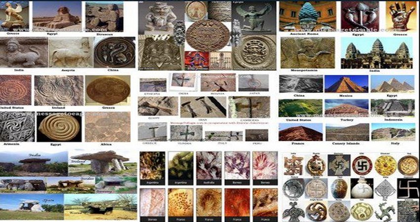 10 Remarkable Similarities Between Ancient Civilizations
-
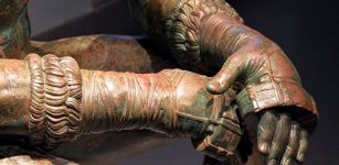 Boxer At Rest – Rare Sculpture And Masterpiece Of Hellenistic Bronze Age Art
-
 Ancient Treasure Hidden In Perplexing Secret Underground Labyrinth In France – Discovery And Forbidden Excavations – Part 2
-
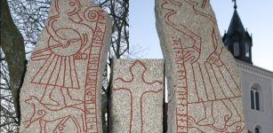 Ledberg Stone (Ledbergsstenen) With Magic Formula Dated To Viking-Era – One Of Most Beautiful Landmarks
-
 Inscription On Pokotia Monolith Reveals Sumerians Visited Peru Thousands Of Years Ago
-
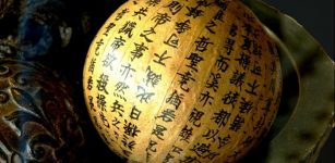 Chinese Writing System – Increasingly Complex Over The Course Of Its 3000-Year History
-
 First People To Enter The Americas Brought Their Dogs With Them
-
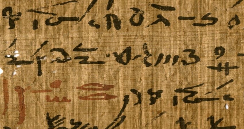 Red And Black Ink Used In Egyptian Papyri Reveal Ancient Writing Practices
-
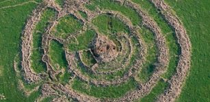 ‘Wheel Of Giants’ And Mysterious Complex Of Circles – Prehistoric “Stonehenge” Monument In The Middle East
-
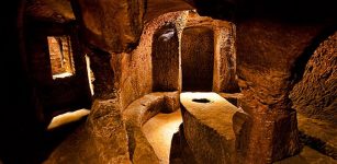 Mystery Of Gilmerton Cove: Underground Maze Of Caves, Passages And Tunnels