
Secrets Of Hidden Submerged Continent Of Zealandia Revealed By Scientists
Cynthia McKanzie – MessageToEagle.com – Scientists are shedding light on some secrets of the long-lost submerged continent of Zelandia.
Zelandia is now being partially mapped, thanks to a deepwater mapping expedition led by The University of Queensland in collaboration with Schmidt Ocean Institute.

Zealandia, the eighth continent between Australia and New Zealand. Credit: University of Queensland
The mostly-submerged continent has New Zealand and New Caledonia rising from its depths and was only put on the map by geologists in 2014.
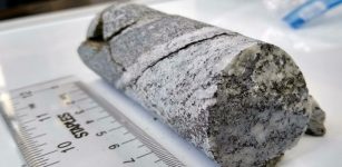
Chief Scientist and UQ researcher Dr. Derya Gürer spent 28 days at sea on Schmidt Ocean Institute’s research vessel Falkor, exploring the north-western edge of the continent located in Queensland’s Coral Sea Marine Park.
“We’re only just starting to discover Zealandia’s secrets—it’s remained hidden in plain sight until recently and is notoriously difficult to study,” Dr. Gürer said.
“Zealandia is an almost entirely submerged mass of continental crust that subsided after breaking away from Gondwanaland 83 to 79 million years ago.
“It spans 4.9 million square kilometers and is around three times the size of Queensland.
“Our expedition collected seafloor topographic and magnetic data to gain a better understanding of how the narrow connection between the Tasman and Coral Seas in the Cato Trough region—the narrow corridor between Australia and Zealandia—was formed.
“The seafloor is full of clues for understanding the complex geologic history of both the Australian and Zealandian continental plates.
“This data will also improve our understanding of the complex structure of the crust between the Australian and Zealandian plates.
“It’s thought to include several small continental fragments, or microcontinents, that were split from Australia and the supercontinent Gondwana in the past.”
The mapping project offered 37,000 square kilometers of data to the Seabed 2030 project.
The project aims to produce a publicly available bathymetric map to measure the depth of the world’s ocean floor depth by 2030.
In addition to seafloor bathymetric data, which measures ocean depths and topographical features, approximately 2500 square kilometers of magnetic data was collected.
UQ’s Dr. Tara Jonell said the team on Falkor also took the opportunity to improve sampling methodology for microplastic monitoring and collected data on seabirds.
“Through the ship’s underway seawater flow-through system, we analyzed more than 100 samples for microplastics, in addition to 40 samples collected on a previous voyage, and only one sample didn’t contain any visible microplastic,” Dr. Jonell said.
Microplastic and plankton discovered on the voyage Dr. Derya Gürer.
Dr. Gürer, who is involved in a citizen science project to tackle marine plastic pollution, said the seawater collected from depths up to 3500 meters held a clear message.
“There seems to be a higher concentration of microplastic fibers in the deep ocean,” she said.
According to Dr. Gürer one of the biggest rewards on the journey was seeing the value of scientific collaboration and the importance of training the next generation of marine scientists.
“Teamwork and a willingness to learn from, and teach each other, made this voyage a success,” she said.
The researchers sampling in the wet lab for microplastics Dr. Derya Gürer.
“We’ve all been operating at the edge of our comfort zone for the past month and it’s been very rewarding to see our emerging scientists grow.
“It’s wonderful to be leading so many up-and-coming earth and marine scientists to learn the ocean’s secrets.”
Written by Cynthia McKanzie – MessageToEagle.com Staff Writer
Related Posts
-
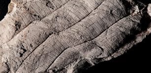 First Leaf Fossil Study Reveals An Ancient 4 Million-Year-Old Forest In Borneo
-
 Geological Phenomenon: Mass Of Warm Rock Is Rising Beneath Surface Of New England
-
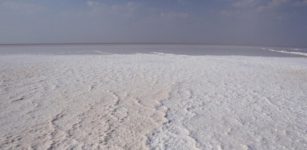 The Unique White Desert Of India In Rann Of Kutch
-
 Terrestrial Water Is Changing Worldwide And Climate Change Is Responsible
-
 Effects Of Climate Change On Indigenous Peoples, Lands And Culture
-
 Rocks Beneath Antarctic Ice Sheet Reveal Surprising Past
-
 Onset Of Modern Sea Level Rise Began In 1863 – International Study Finds
-
 Blocking The Sun To Control Global Warming
-
 Systematic Warming Pool Discovered In The Pacific Due To Human Activities
-
 Sea-Level Rise In 20th Century Was Fastest In 2,000 Years Along Much Of East Coast