
Stunning View Of What Supercontinent Pangea Looks Like Mapped With Modern Borders
Cynthia McKanzie – MessageToEagle.com – Can you see your country on this stunning map?
Imagine traveling from China to Antarctica, crossing through Canada, Brazil and India – without setting foot in any water.
Unfortunately, you’ve missed your chance long ago as the supercontinent of Pangea no longer exists.
Have you ever wondered what the supercontinent Pangea would look like if mapped with modern borders? Here is your chance to see it. This is a great image that displays the supercontinent if it existed today.

About 250-300 million years ago, all of Earth’s continents were joined together in a super-continent called Pangea.
This huge continent started to break apart after about 100 million years. However, this does not stop us from re-creating the continent and see what it looked like.
The image was created by Massimo Pietrobon, and here you can see how Pangea may have looked before the epic landmass started ripping itself apart 200 million years ago to form the continents and countries of the world today.
See also:
Amasia (‘Pangaea Proxima’): Next Supercontinent Will Appear And Form One Continent On Our Planet
Amasia – New Future Supercontinent
Piece Of A Long-Lost Continent Discovered Under Mauritius
Surrounded by a superocean called Panthalassa, the bulk of Pangea was in the southern hemisphere, unlike how the continents are spread out now.
Evidence for Pangea has been found in similar fossils recently discovered in South Africa, India and Australia, such as the therapsid Lystrosaurus and similar rock forms seen between the eastern coast of South America and the western coast of Africa.
Written by Cynthia McKanzie – MessageToEagle.com Staff Writer
© MessageToEagle.com
Related Posts
-
 Scientists Now Know Why The Climate Underwent Dramatic Changes At The End Of The Last Ice Age
-
 How Low Did It Go? Study Seeks To Settle Debate About Oxygen In Earth’s Early Atmosphere
-
 Does The Climate In Game Of Thrones Make Sense?
-
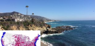 Sea Level Rise Will Affect Every County In The US And Trigger Migration Inland
-
 Urgency To Tackle Climate Change – Tipping Point Could Be Coming Sooner Than Thought
-
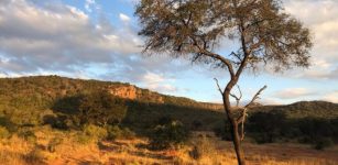
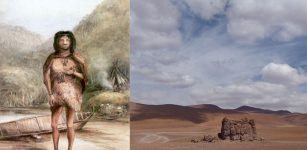 Major Earthquake Struck The Atacama Desert 3,800 Years Ago, Forcing Hunter-Gatherers To Move Inland
-
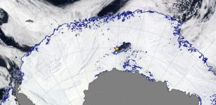 Mystery Of Polynya In Antarctica – What’s Causing This Strange Phenomenon?
-
 Is Ozone Heating Our Planet More Than We Realize?
-
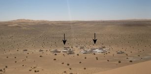 Evidence Of Ancient Lakes In The Sahara Desert Discovered
-
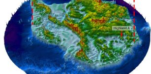 Unknown Ancient World Discovered Beneath East Antarctic Ice Sheet