
Researchers Pinpoint Location Where Massive Earthquakes Will Strike
Eddie Gonzales Jr. – MessageToEagle.com – UC Riverside scientists have found a method to pinpoint where the largest earthquakes on Earth are most likely to occur, providing a powerful new tool to help prepare for disasters in some of the most dangerous earthquake zones.
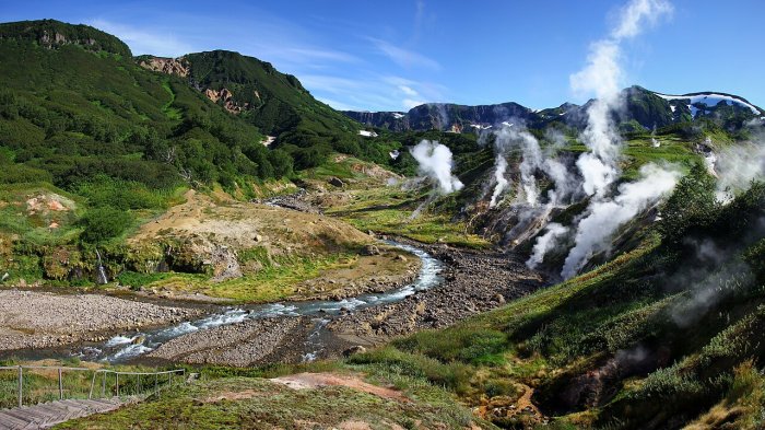
The Valley of Geysers in 2018. Image credit: – CC BY-SA 4.0
In a recent observation, the researchers found that their model highlighted the exact section of the Kamchatka subduction zone in eastern Russia where a massive earthquake later occurred.
UCR geophysicists Gareth Funning and Axel Periollat, who led the study, worked on how the Earth’s surface slowly changes as tectonic plates lock together and then break apart.
“Earthquakes capture headlines when they happen, but for years beforehand the fault is quietly accumulating strain,” Funning said. “This strain can be measured.”
Using GPS measurements, the researchers developed a new algorithm that identifies portions of faults that are locked and storing energy. These locked regions, known as asperities, act like patches of friction that resist motion until enough stress builds to trigger a major earthquake.
The researchers had identified one such locked region beneath Russia’s Kamchatka Peninsula before a large earthquake struck there. While the timing of the event was beyond the scope of their method, the rupture occurred exactly where their model indicated strain had accumulated.
“We had an idea where the strain was accumulating based on a relatively limited data set,” Periollat said. “Seeing it work so well confirmed that this approach has real potential.”
The findings also revealed that earthquakes occurring in the same region can behave differently. Although Kamchatka experienced giant earthquakes in both 1952 and 2025, the more recent event generated a much smaller tsunami, suggesting the shallowest portion of the fault slipped less than during the earlier rupture.
The researchers emphasize that their method cannot predict tsunami size or earthquake timing. However, narrowing down where the greatest hazards exist could improve long-term planning and preparedness.
The team is now applying their approach to other major subduction zones in Japan, Mexico, New Zealand, and the Pacific Northwest. Each presents additional complexities, such as events that release energy gradually rather than in sudden earthquakes.
They are also exploring whether similar techniques can improve understanding of California faults.
“In the Bay Area, the Hayward Fault has both creeping and locked sections, much like subduction zones,” Funning said. “We’re investigating whether we can identify the parts most likely to generate future earthquakes.”
Applying the method more broadly will require better observations. While GPS stations on land provide valuable information, scientists have far fewer measurements offshore, where many of the world’s most dangerous faults lie beneath the ocean.
Researchers in Japan have begun using acoustic instruments placed on the seafloor to measure slow deformation over many years, and similar efforts are being proposed elsewhere, including Chile and the Pacific Northwest. A recently launched satellite could eventually provide additional measurements in regions that currently lack GPS coverage.
The work also highlights major gaps in global earthquake monitoring, particularly in parts of the Pacific where limited data make it difficult to assess tsunami hazards.
The researchers stress that improved forecasting of earthquake locations should complement, not replace, public preparedness.
“Your peace of mind shouldn’t come from believing we can forecast the exact earthquake,” Funning said. “Especially where we live in Southern California, it’s not a matter of if, but when. There is no substitute for preparation.”
The team believes their algorithm could eventually help scientists evaluate seismic hazards in many of the world’s most active plate boundaries, provided sufficient data become available.
“We can identify where large earthquakes are likely to occur, even if we can’t predict exactly when,” Periollat said. “With better observations and continued monitoring, we can learn much more about Earth’s most dangerous faults.”
Source – UC Riverside – via EurekAlert
Written by Eddie Gonzales Jr. – MessageToEagle.com Staff Writer
Related Posts
-
 Why The Algorithm Can Fail In Identification Of Precipitation Types Over The Tibetan Plateau – Study
-
 Ancient Diamonds Shine Light On The Evolution Of Earth
-
 Solar Geoengineering Could Save 400,000 Lives A Year, Georgia Tech Study Says
-
 Ice May Release More Iron Than Climate Models Predict – Study From Umeå University
-
 Peak Glacier Extinction: The Alps To Lose A Record Number Of Glaciers In The Next Decade
-
 Ventilation Of The North Atlantic Is Weakening
-
 Oceanic Currents In Antiquity Serves As A Harbinger Of Future Climate Problems
-
 Wind Patterns Can Predict Record-Low Antarctic Sea Ice Months In Advance
-
 Discovery Of White Hydrogen In Ancient Canadian Shield Rock Suggests A Promising New Energy Source
-
 Ancient Irish Volcano And New Clues About The Development Of Its Modern-Day, Active “Brothers And Sisters”

