
Rare Isotopes Help Unlock Mysteries In The Argentine Andes
Eddie Gonzales Jr. – MessageToEagle.com – Every second the Earth is bombarded by vast amounts of cosmic rays—invisible sub-atomic particles that originate from things like the sun and supernova explosions. These high-energy, far-traveled cosmic rays collide with atoms as they enter Earth’s atmosphere and set off cascades of secondary cosmic rays.
When secondary cosmic rays penetrate the upper meters of Earth’s surface, they turn elements in minerals, like oxygen, into rare radioisotopes (or “cosmogenic radionuclides”) including beryllium-10 (Be-10) and carbon-14 (C-14). Scientists can then study the variations in concentrations of these cosmogenic nuclides to estimate how long rocks have been exposed at the Earth’s surface.

Aerial view of the study region in the Argentine Andes. Credit: J.R. Slosson
This in turn allows researchers to gain a better understanding of planetary processes, such as rates of erosion—from nothing more than a kilogram of river sand.
Gregory Hoke, the Jessie Page Heroy Professor and department chair of Earth and environmental sciences at Syracuse University’s College of Arts and Sciences, J.R. Slosson, a postdoctoral researcher at UMass Amherst who received a Ph.D. from Syracuse University, and Nat Lifton, associate professor of Earth, atmospheric and planetary sciences at Purdue University, recently co-authored a study published in Geophysical Research Letters analyzing cosmogenic radionuclides in samples from the Argentine Andes.
The goal of the project was to document the amount of time material resides on the hillslopes in the Andes Mountains relative to the overall erosion rate of the river basin. This information is critical to helping scientists identify landslide risks and understand how climate change will impact the dynamics of material transport on hillslopes as regions get wetter or drier.
History written in the sand
To determine erosion rates, the team obtained samples of river sand collected at the foot of the eastern flank of the Andes Mountains in the Mendoza and San Juan provinces, located in west-central Argentina. The river sand is to be a representative, well-mixed sample of the entire catchment (or runoff area) upstream of where the sample was collected.
In Hoke’s lab at Syracuse University, the sand was treated to isolate pure quartz from the other minerals present in the sample. The researchers use pure quartz because it is an optimal source for Be-10 and C-14. Splits of pure quartz were sent to the University at Buffalo and Lifton’s lab where beryllium and carbon were extracted, respectively. Subsequent measurements of C-14 were performed at Purdue University’s PRIME Lab and Be-10 was analyzed at Lawrence Livermore National laboratory to figure out concentrations of each radionuclide.
A tale of talus
The highest non-volcanic peaks in the Andes are located between Santiago, Chile and Mendoza, Argentina. The river basins that drain the high Andes span 5,000 m (16,500 ft) in elevation and their hillslopes are lined with accumulations of rocky debris known as talus and scree.
Because Be-10 and C-14 are produced proportionally but decay at vastly different rates, the cosmogenic radionuclide concentrations within a sample reveal the rate at which sediment is produced from bare rock surfaces (Be-10) and the time it takes to travel down hillslopes through landslides (C-14).
As sediment is mobilized and buried through landsliding, the rate of production of both isotopes diminishes, but because C-14 decays 1,000 times faster than Be-10, their proportionality changes rapidly. This change in proportionally allowed the authors to apply a statistical model to determine the average duration of time it takes material to travel down talus slopes.
EES professor Gregory Hoke co-authored a study investigating how long material resides on hillslopes in the Andes Mountains.
According to author Gregory Hoke, this is one of the first studies to use the combination of Be-10 and C-14 to show the long-term average rate of sediment generation and the time and process it takes to move down to and through the rivers, giving a broader picture of the factors involved.
“Previously, we’ve relied nearly exclusively on Be-10 and sediment concentration measurements made at river gauge stations to estimate average erosion rates,” notes Hoke. “What attracted us to study these catchments with C-14 was the agreement of gauge and Be-10 data. We expected to see the two isotopes and gauge data yield the same rates and demonstrate that mountain erosion was occurring at a steady state.”
While the concentration of Be-10 came back as anticipated over the long timescale, they found that C-14 was much lower than anticipated, meaning that sediments eroded from the high mountain watersheds were shielded from cosmic rays for at least 7 to 15 thousand years. The authors explain that temporary storage in talus slopes best explains the lower concentration of C-14 relative to Be-10.
“This study shows that it is possible to fill an important gap in the observational timescale using the C-14/Be-10 pair that brings to life what really happens on the hillslopes,” says Hoke.
With the risk that landslides pose to humans and infrastructure, J.R. Slosson says their results indicate that C-14 can be significant in unraveling sediment transport dynamics going forward, and potentially help predict where future landslides might occur. He explains, “utilizing C-14 along with Be-10 provides a new window into the complexity of sediment transport in mountain settings and can provide a backdrop for evaluating contemporary changes in earth surface processes.”
Written by Eddie Gonzales Jr. – MessageToEagle.com Staff
Related Posts
-
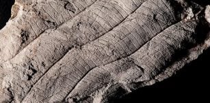 First Leaf Fossil Study Reveals An Ancient 4 Million-Year-Old Forest In Borneo
-
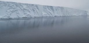 Probing The Mysteries Of Deep, Dense Antarctic Seawater
-
 Hawaiian-Emperor Undersea Mystery Revealed With Supercomputers
-
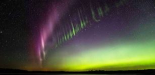 Mysterious STEVE Light Emissions Emanate From Earth’s Magnetosphere
-
 Rapid Decline Of Global Glaciers With Extreme Losses Continuing In 2025
-
 Rain Observed On Greenland For The First Time – Signals Of Climate Change Risk
-
 We Can Now Save And Protect Ash Trees From Deadly Beetle – Resistance Genes Have Been Found
-
 74% Of The World’s Population Will Be Exposed To Killer Heatwaves By 2100
-
 Terrestrial Water Is Changing Worldwide And Climate Change Is Responsible
-
 Climate-Driven Megadrought Is Emerging In Western US – What Can We Expect?