
Satellite Images Of 66 New Roman Army Sites Show More Clues About One Of The Empire’s Most Infamous Conflicts
Jan Bartek – MessageToEagle.com – Remote sensing technology has revealed more about one of the Roman Empire’s most infamous conflicts. The discovery of dozens of new Roman Army sites shows the Roman army had a larger presence in the region than previously thought during the 200-year battle to conquer the Iberian Peninsula.
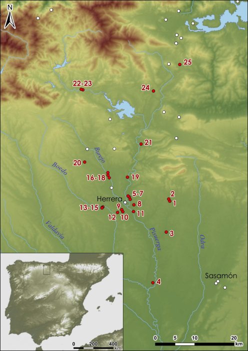
Roman military presence in Castile. Credit: romanarmy.eu
The discovery of camps of different sizes, used for training and shelter has allowed experts to map how soldiers attacked indigenous groups from different directions and to learn more about the footprint of the Roman military presence in the northern fringe of the River Duero basin—the León, Palencia, Burgos and Cantabria provinces.
These temporary occupations usually left fragile and subtle traces on the surface. The ditches or the earth and stone ramparts protecting these fortifications have been filled in and flattened. Combining different remote sensing images and fieldwork shows the perimeter shape of the temporary Roman military camps, often a rectangle like a playing card.
These new sites are located at the foothills of the Cantabrian Mountains, where the conflict between Romans and natives was focused at the end of the 1st century BC. This suggests soldiers crossed between lowlands and uplands, using ridges in the mountains to stay out of site and give themselves more protection.

Aerial photographs of the camp of Tortolondro (black) (A), the Roman road (white) and the camp (black) at Quintanilla de Riofresno. Credit: romanarmy.eu
The fact there were so many army camps in the region shows the immense logistical support which allowed soldiers to conquer the area. Sites were used to aid movement to remote locations and to help soldiers stay in the area over the cold winter months. Some of the camps may have housed soldiers for weeks or months, and overs overnight.

Credit: Public Domain
The aim of the occupation was to expand the empire and to be able to exploit natural resources such as tin and gold.
“We have identified so many sites because we used different types of remote sensing. Airborne laser scanning gave good results for some sites in more remote places because it showed earthworks really well. Aerial photography worked better in lowland areas for the detection of cropmarks,
The remains are of the temporary camps that the Roman army set up when moving through hostile territory or when carrying out maneuvers around their permanent bases. They reveal the intense Roman activity at the entrance to the Cantabrian Mountains during the last phase of the Roman conquest of Hispania,” João Fonte from the University of Exeter said in a press statement.
There is an important concentration of 25 sites along the valleys of northern Palencia and Burgos, as well as southern Cantabria. In the province of León, as many as 41 sites have been documented in different valleys. These range from small forts of a few hundred square meters to large fortified enclosures of 15 hectares.
See also: More Archaeology News
Most of these Roman military sites were located in close proximity of later important Roman towns. Sasamón, a village in Burgos that was probably where nearby Emperor Augusto established his camp during his presence in the front.
The research will continue so experts can examine the relationships the Romans established with indigenous communities, named Vaccaei, Turmogi, Cantabri, Astures and Callaeci, according to the Greek and Latin sources.
Written by Jan Bartek – MessageToEagle.com – AncientPages.com Staff Writer
Related Posts
-
 Pre-Columbian Societies Declined 2,000 Years Ago Due To Sea Level Fall
-
 The Third Greatest Fire Temple That Existed In Ancient Iran’s Sassanid Age – Unearthed
-
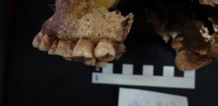
 Scientists Explore How Neanderthals Caught Birds In Caves For Food
-
 Ancient Clay Seals That Could Re-Write Hittite History Discovered In Kayalıpınar, Turkey
-
 Milk Enabled Massive Steppe Migration
-
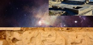 Cosmic Message Of The Zapotec Glyphs In The Valley Of Oaxaca – Deciphered!
-
 Invention Of Ancient Military Technologies Throughout World History Investigated
-
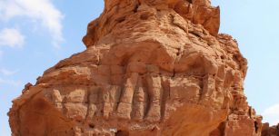 Unique Life-Sized Camel Carvings In Northern Arabia Are Much Older Than Previously Thought
-
 John Dee’s Magical Mirror Used To Contact Spirits Can Be Traced To The Aztecs
-
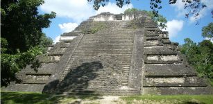 History Set In Stone – Maya Rulers Put Their Personal Stamp On Ancient Monuments